Assiniboine River Peaks in Brandon
April 11, 2017
FOR IMMEDIATE RELEASE
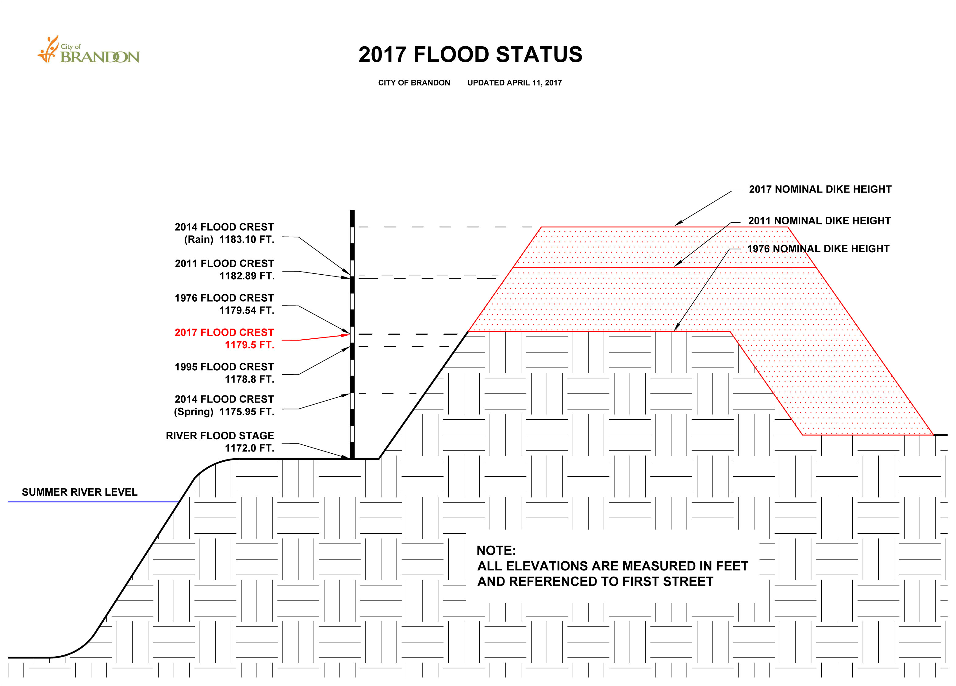
The Assiniboine River in Brandon was measured at First Street this morning at a level of 1,178.83 feet above sea level, down slightly from yesterday afternoon’s level.
Manitoba Infrastructure’s Hydrologic Forecast Centre has recorded the Assiniboine River’s official peak level in Brandon as 1,179.50 feet above sea level, measured at First Street, on April 9th - making this spring melt event a tie for Brandon’s 4th highest river level on record.
The City of Brandon’s Emergency Response Team will continue 24/7 monitoring activities in the coming days to ensure the river recedes from the dike system, after which work to remove the clay plug from Grand Valley Road at the intersection of 18th Street North will be considered. Of course, this timeline would be impacted by any rainfall events.
Manitoba Infrastructure continues to monitor the aqua dams it placed along First Street North and will remove them at its own discretion.
Once more, City officials would like to ask the public NOT be accessing any portion of the City’s dike system by foot, bicycle or otherwise. Specifically, the recently-built-up embankment at the Wheat City Golf Course has not been water-tested to this level before and its stability remains unknown. Management and staff at the Wheat City Golf Course ask all members of the public to respect all signage and barricades placed in the course's parking lot until the peak has passed.
All public access into Dinsdale Park and Queen Elizabeth Park (including the Queen Elizabeth Park entrance at 26th Street North) is STRICTLY PROHIBITED until further notice. Barricades are up in these areas and are being monitored to ensure public adherence.
The City of Brandon’s Emergency Response Group is now preparing the Community Impact Assessment and the City Council resolution necessary to apply for Disaster Financial Assistance.
